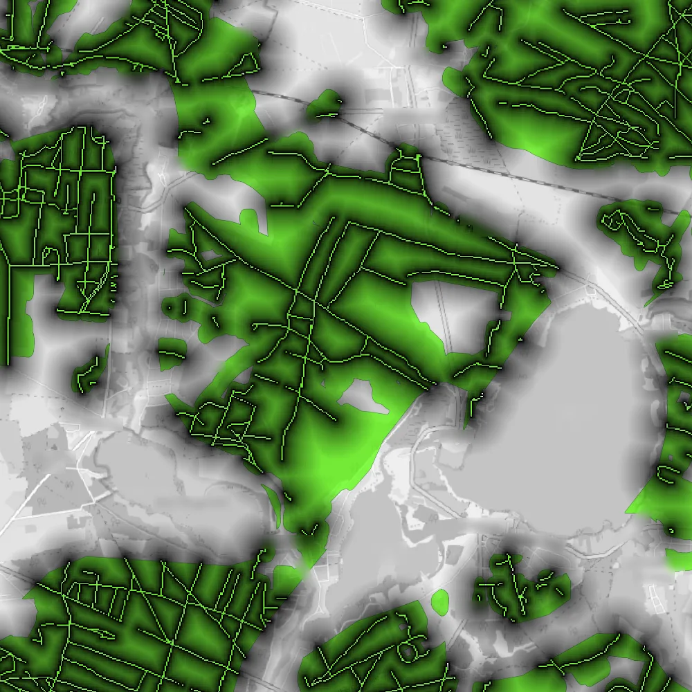
Mushroom Map

Increasing the chances of finding mushrooms through geospatial data analysis

Image of the map

Approach

  • Obtained a dataset of forest types (needle-leaf, broadleaf, mixed, etc.)
  • Filtered out the types that are typically not suitable for mushrooms to grow in
  • Obtained a list of paths and trails from OpenStreetMap and generated a distance field around them
  • Superimposed the trails and distance map on the forest regions of interest

Result

The final map shows the forest regions that are suitable for mushrooms to grow in and the distance to the nearest path or trail; the idea being that the further away from the path you search, the less likely it is that someone else has already found and picked the mushrooms.

All experiments
Applied
Finding interesting configurations for a generative artwork through data analysis
Experiment
Mushroom Map
Increasing the chances of finding mushrooms through geospatial data analysis
Experiment
Simulating blobs of fluids with particles
Experiment
Modified JPEG encoder for generating glitchy image effects
Experiment
Force-based simulation of bands of particles
Experiment
Mapping line drawings onto street networks
Experiment
GPS trace replay tool
Misc
Proof-of-concept for an alternative, more powerful Are.na client
Misc
Browser extension that collects texts of how designers describe themselves
Applied
Visualization showing how a text document got written and edited over time
Experiment
Experiments with movie image data
Applied
InDesign script that enforces alternating line lengths